Flight planning for iPhone

FlightSpace

Weather for your UAV flight.

Check wind at altitude, weather along your route and your aircraft limits. Understand the conditions before takeoff.

Free to downloadNo accountNo ads

Up to 5,000 m
vertical weather profile
Up to 250 km
route analysis
Multi-source
forecast comparison

Built around your flight

A forecast is only the starting point.

Calm weather on the ground does not tell the whole story. FlightSpace helps you check the conditions where your UAV will actually fly.

  • At your working altitudeSee how wind and temperature change above the ground.
  • Along your routeFind weather limitations between the start and destination.
  • Against your own limitsCompare the forecast with the limits you set for your UAV.
Explore the planning workflow
FlightSpace dashboard with weather and flight assessment

How it works

Plan your flight in three steps

01
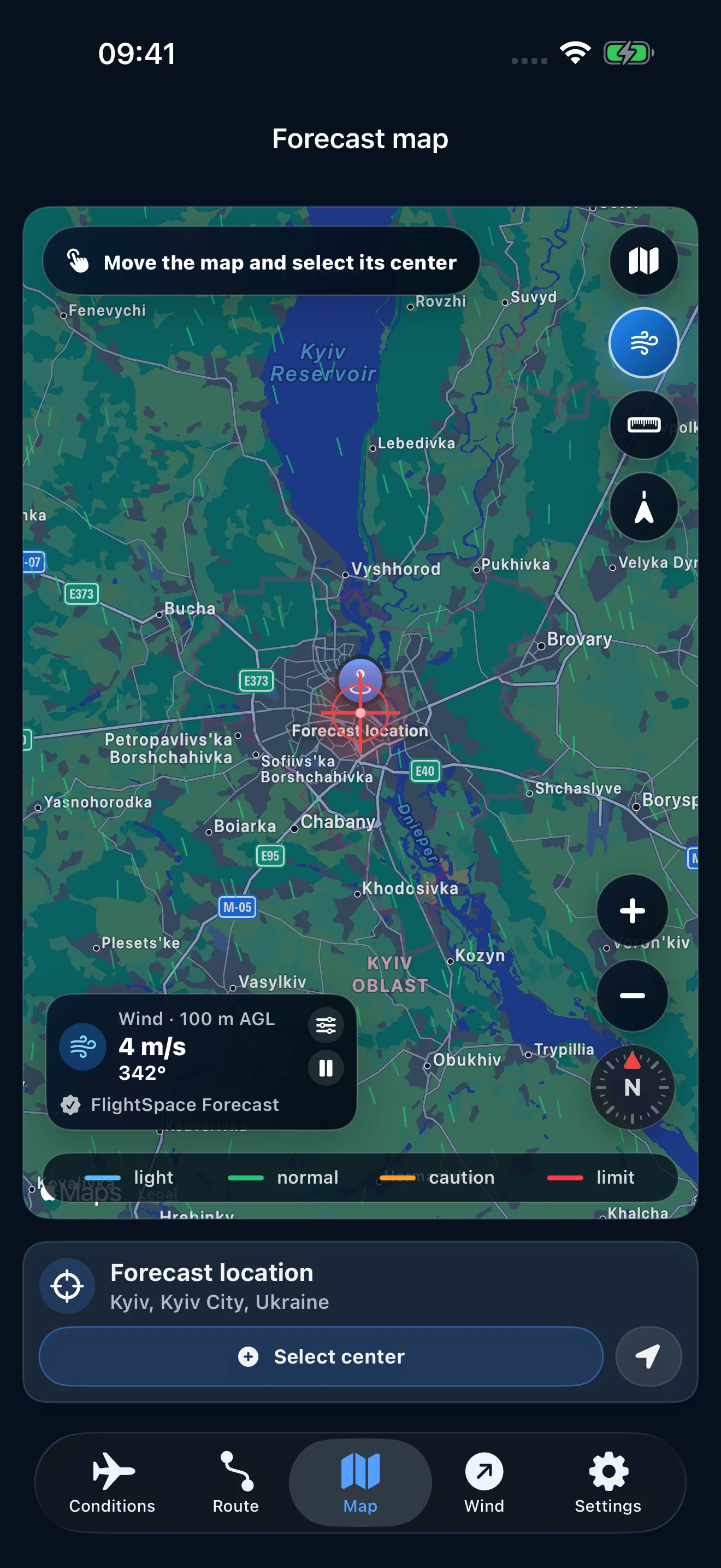
Selecting a point on the FlightSpace map

Choose a point or route

Mark the start and destination or analyze a single location.

02
Working altitude and UAV weather limits in FlightSpace

Set altitude and UAV parameters

Define working altitude, maximum wind and other critical operating limits.

03
FlightSpace condition assessment result

Get a condition assessment

See weather risk and the factors outside your selected limits.
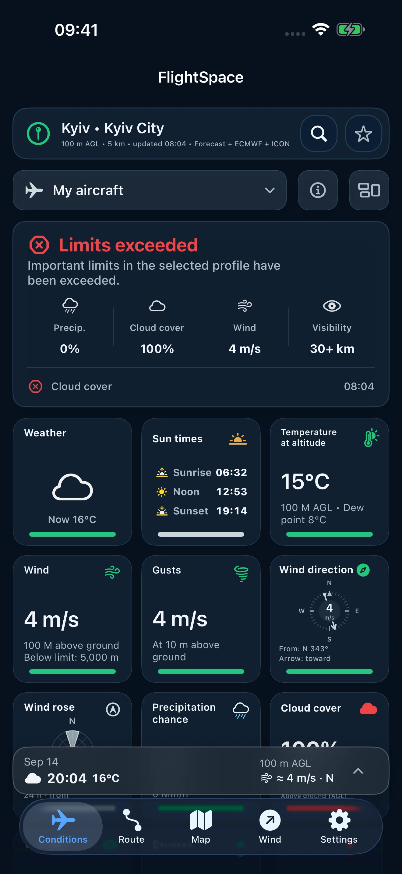
FlightSpace shows both the assessment and the factors behind it. Screenshots illustrate the interface, not current weather.
Product demo

From route to decision

Watch FlightSpace Pro in action: analyze a route, see weather limitations and explore the wind profile by altitude. This is a real app recording.

  1. Choose a point or route
  2. Analyze conditions and selected limits
  3. Explore wind at different altitudes
24 seconds · FlightSpace Pro · no sound

Condition assessment

Know which conditions need attention.

Wind, gusts, precipitation and visibility are compared with your settings. See what is within limits and what needs a closer look.

FlightSpace condition dashboard
Your limits come firstAssess conditions against the thresholds you set for your UAV.Wind at working altitudeCheck the altitude profile, not only the wind near the ground.Compare available forecastsSee where sources agree and where the forecast needs caution.Choose the time of flightReview forecast conditions for the time you plan to take off.

Based on your selected weather limits. “Favorable conditions” means the checked parameters are within the UAV limits you configured. It is not a guarantee of safety or legal compliance.

Route analysis

Check the route, not just the launch point.

Conditions can change between takeoff and arrival. Check weather along a route up to 250 km and identify sections that exceed your selected limits.

FlightSpace route map with takeoff and target markers
250 km
maximum route analysis
Altitude aware
weather along the flight profile
Limit detection
the segment creating a limitation
Ground stationAircraft
Example · 900 MHz
LOS60% FresnelTerrain

Terrain and radio visibility

Terrain, LOS and Fresnel clearance

See what lies between the ground station and the aircraft. Radio frequency is used to calculate the first Fresnel zone.

  • Digital terrain profile
  • Direct line of sight
  • 60% first Fresnel-zone clearance
  • Ground-station and aircraft altitude

A digital terrain model cannot include every local obstacle, tree, structure or source of radio interference.

Weather intelligence

Surface weather is only part of the picture.

Compare weather at your working altitude and across available sources. Agreement helps show where forecasts differ; it is not a guarantee of accuracy.

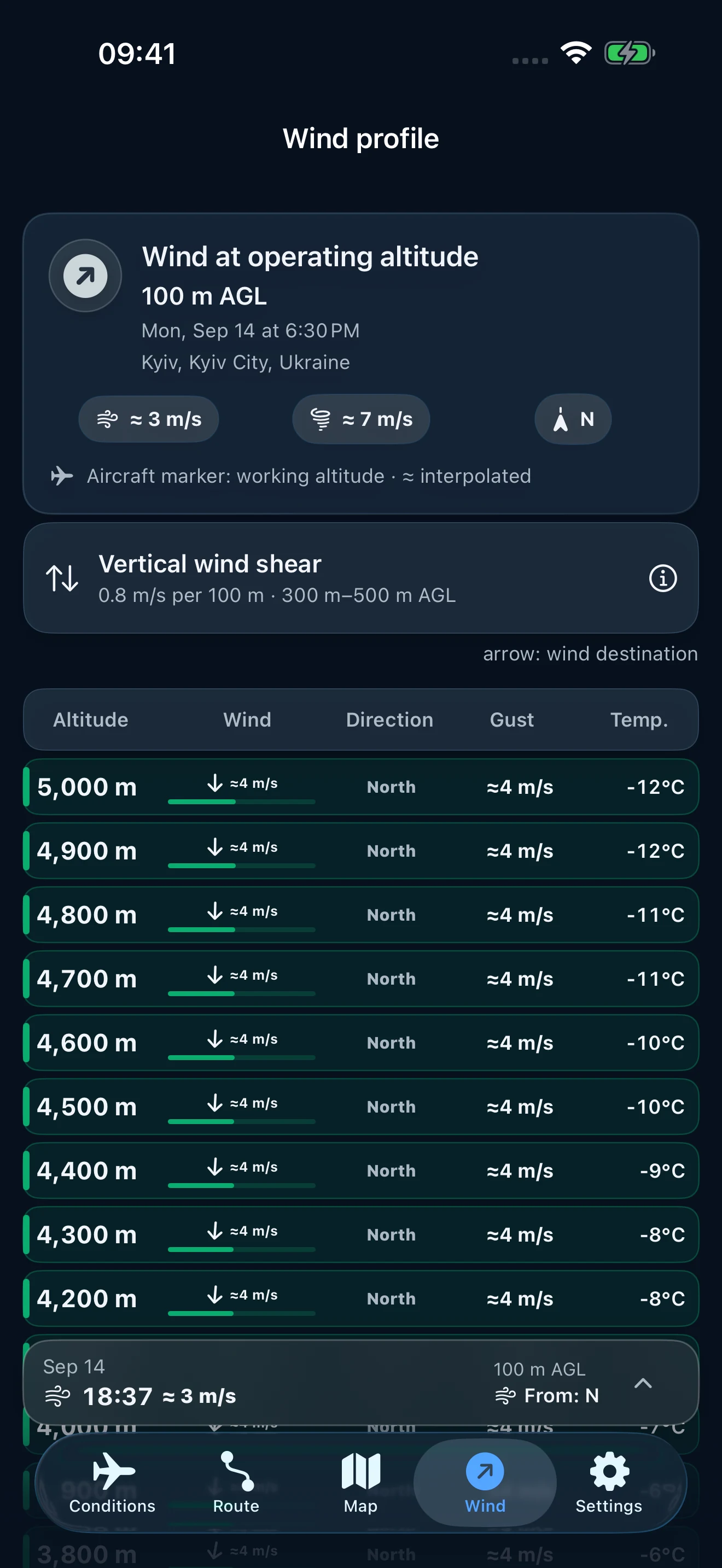
Altitude profile

Weather changes with altitude

Above Ground Level means altitude above the surface.

Wind, temperature and humidity at working altitude can differ significantly from surface conditions.

Illustrative wind profile; values are not a live forecast.

5,000 m18 m/s
4,000 m15 m/s
3,000 m11 m/s
2,000 m8 m/s
1,000 m6 m/s
0 m3 m/s
FlightSpace wind profile by altitude

Source comparison

Do not rely on one forecast

It shows how close the available forecast values are. It does not measure future forecast accuracy.

FlightSpace shows how closely available sources agree for a single weather parameter.

Example wind-speed comparison

ECMWF8 m/s
ICON9 m/s
GFS8 m/s
Apple Weather8 m/s
AgreementHigh92%

92% represents agreement between forecast sources, not forecast accuracy.

Supported sources include ECMWF, ICON, GFS, Apple Weather and additional automatically selected sources. Parameter availability depends on region and forecast horizon.

UAV limits

One forecast does not fit every UAV

Different aircraft have different acceptable conditions. FlightSpace compares the forecast with weather limits set by the operator.

Illustrative values, not a live forecast. Your own aircraft limits take priority.

Your aircraft

Maximum wind
12 m/s
Maximum gust
16 m/s
Minimum visibility
3 km
Rain
Not permitted

Current conditions

Wind
9 m/s
Gust
14 m/s
Visibility
2.4 km !
Rain
0 mm
FlightSpace resultLimitation: visibility

The current value is outside the selected minimum limit.

Weather window

Not now? Find out when.

Example window: +4 h

Nowlimitation
+2 hcaution
+4 hfavorable
+6 hfavorable

Privacy

Your flight data is your data

FlightSpace collects only what is required to provide forecasts and app functionality.

No accountNo separate FlightSpace account is required
No adsNo advertising network
No trackingNo marketing tracking between apps
Local dataSettings, routes and bookmarks are stored locally where technically possible
iPhoneForecast requestWeather providerResult in FlightSpace

Coordinates are used to obtain the forecast for the selected location. Details depend on the active weather source.

Learn more about privacy

FlightSpace Pro

Start with the weather. Go further with Pro.

Free

For a quick weather check

  • Forecast for a selected location
  • Basic weather condition assessment
  • Weather data up to 100 m
  • GFS forecast source
Download
7-day free trial

with the annual plan

Pro

For detailed flight planning

  • Everything in Free
  • Weather up to 5,000 m
  • Route analysis up to 250 km
  • Terrain, LOS and Fresnel clearance
  • ECMWF, ICON, GFS and Apple Weather comparison where available
  • Bookmarks, saved routes, offline cache and field tools
View on the App Store

Pricing varies by App Store region. The trial is available with the annual plan to eligible new subscribers under Apple's terms; purchase terms are shown before confirmation.

Use cases

For different types of flight

Fixed-wing

Long-range routes

Altitude-aware weather, route risks and a suitable operating window.

Multirotor

Inspection

Wind, gust and visibility checks at the working altitude near the asset.

FPV

Preflight awareness

A quick check of precipitation, cloud, wind and selected aircraft limits.

Survey

Mapping

Route planning and stable conditions for consistent data collection.

FAQ

Questions about FlightSpace

What is FlightSpace?

A professional iOS app for UAV flight planning with altitude weather, routes, terrain and weather-risk assessment.

How is FlightSpace different from a normal weather app?

It evaluates conditions at working altitude and along a route, then compares them with the limits of a specific UAV.

What UAVs can I use FlightSpace with?

Fixed-wing aircraft, multirotors, FPV, mapping and inspection UAVs. The operator defines the limits.

What does AGL mean?

Above Ground Level means altitude above the surface rather than altitude above sea level.

How far can FlightSpace analyze a route?

Up to 250 km, depending on the available plan and forecast-data coverage.

What weather sources does FlightSpace use?

Forecasts from Open-Meteo are delivered through the FlightSpace server. Apple Weather uses WeatherKit. Available parameters depend on the selected source, location and forecast period.

Does 92% agreement mean 92% accuracy?

No. It describes how similar the available forecast values are, not the accuracy of future weather.

Does FlightSpace replace official aviation information?

No. Always check NOTAMs, airspace restrictions, local regulations and actual conditions.

Does FlightSpace store my routes or coordinates?

Routes, bookmarks and settings are stored locally where technically possible. Coordinates are sent to weather services only to fulfill a forecast request.

What is FlightSpace Pro?

The advanced plan with weather up to 5,000 m, route analysis, terrain, LOS/Fresnel, forecast comparison and offline capabilities.

Community

Connect with FlightSpace

Follow product news and updates, or join the conversation with other FlightSpace users.

FlightSpace for iPhone

Your next flight starts with the right information.

Download FlightSpace on your iPhone. Start with the free forecast, then explore Pro when you need altitude and route analysis.

Download on the App Store
QR code to download FlightSpace on the App StoreScan with iPhone